
Bedford Township ZIP Code Coverage
Bedford Township is a civil township in southern Monroe County, so postal city and local jurisdiction are not the same field. The verified principal ZIP codes are 48182 for Temperance, 48144 for Lambertville, and 48177 for Samaria. County planning material also shows nearby 48133 and 49267. Those two are edge cases, not universal Bedford Township assignments. A parcel-level GIS and USPS check is needed before treating either as part of a local records search.
| ZIP | Bedford delivery area | Post office | Record note |
|---|---|---|---|
| 48182 | Temperance and most Bedford Township delivery addresses outside Lambertville | Temperance, 8149 Lewis Avenue | Main Bedford postal identity; postal city is not municipal status |
| 48144 | Lambertville area in southwest Bedford and nearby delivery area | Lambertville, 8213 Secor Road | Check the parcel and township for boundary addresses |
| 48177 | Samaria area and nearby delivery area | Samaria, 1344 Samaria Road | Older records may use the Weeksville or Samaria label |
| 48133 | Regional Erie-area delivery area | Erie, 9780 S Dixie Highway | Not assigned to all of Bedford Township |
| 49267 | Regional Ottawa Lake delivery area | Official post-office detail was not captured | Possible edge-case mailing area only, not a general Bedford assignment |
The Bedford Township ZIP code directory is therefore a starting map, not a fixed city list. The Monroe County Parcel Viewer supplies the better test for a close boundary, and USPS supplies the best current delivery check. A returned ZIP does not confirm that a particular person or organization is at an address.
Bedford Township Postal Place Names
Postal names carry the local history that makes a ZIP search less mechanical. West Erie Post Office began in 1834 and became Lambertville in January 1836. Samaria was once called Weeksville and received a post office in 1879. Bedford Center became Temperance with its 1884 post-office change. An old directory, deed, census entry, or newspaper notice can use one of those earlier names while still pointing to the area now known as Bedford Township.
Do not turn those label changes into a street-number theory. The inspected sources did not provide a complete modern renumbering or readdressing schedule. Preserve the exact historical label, then bridge records with a parcel/SBL, legal description, plat, cross street, and approximate year. The 1876 Bedford Township plat and the current GIS viewer are sounder continuity tools than a postal-city guess.
Note: Every historical search should retain Monroe County and the civil-township name because Bedford appears in other Michigan locations.
Check Bedford Township ZIP Codes
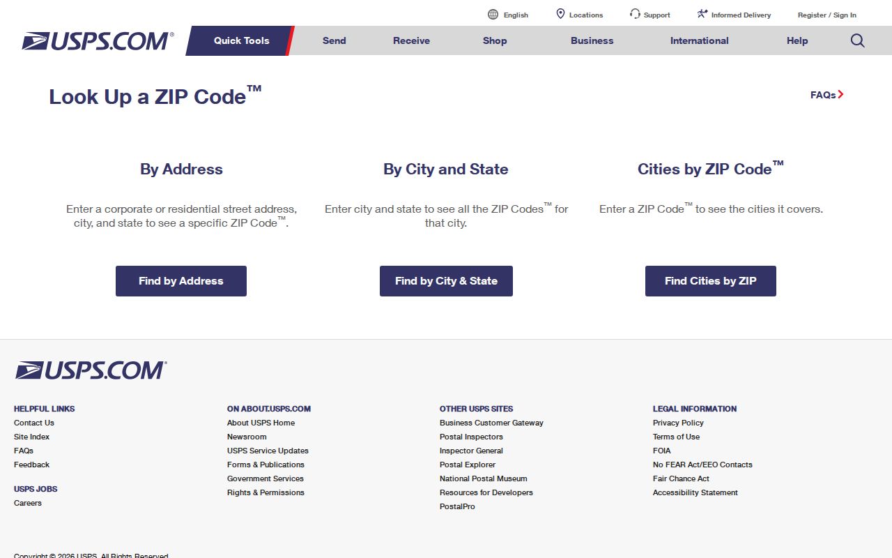
The official USPS ZIP Code Lookup has three useful paths: full address, city and state, or ZIP-to-cities. The address form has company as an optional field and requires street information, while apartment, suite, or other unit information can refine an address. The city-and-state path helps identify ZIP choices, and the reverse path shows the cities associated with a ZIP. USPS expressly warns that a returned ZIP does not verify a person or organization at that address.
| USPS lookup path | Fields or input | What it verifies |
|---|---|---|
| Address to ZIP | Street required; company optional; unit, city, state, and ZIP as available | Official delivery ZIP for the supplied address |
| City and state | City and state | ZIP choices associated with the postal place |
| ZIP to cities | ZIP | Postal cities associated with that ZIP |
The USPS ZIP Code Lookup screen provides those address and postal-place paths.
After USPS returns a delivery label, check it against a Monroe County parcel. A Temperance mailing address, for example, can still need a township-boundary verification for records work. This extra check prevents a postal result from being mistaken for a local-government jurisdiction.
Find Residents by Bedford Township ZIP
A ZIP-based search should remain a property and geography workflow. It can create a set of parcels or delivery addresses, but it cannot establish everyone living within that set. Use a current delivery ZIP, then let the GIS layer and assessment record identify the parcel. If the research goal becomes a complete named street, the parcel-by-parcel approach on the Bedford Township street directory is the appropriate next step.
- Verify the address with USPS and keep the street number, unit, postal city, state, and returned ZIP together.
- Open the Monroe County GIS viewer, turn on ZIP, parcel, and township-boundary layers, and search or query the address, ZIP, or parcel as the viewer supports.
- Record the parcel’s `countysbl`, situs address, and `parceladdresszipcode`, then compare the boundary display before assigning it to Bedford Township.
- Use Bedford BS&A’s detailed property search when its active module exposes address or ZIP filtering. Treat the result as parcel data, not a directory of occupants.
- For registration information, use MVIC for an individual lawful status check. The formal QVF request uses township, district, school, village, or precinct scope rather than an ordinary ZIP roster.
The Monroe County Parcel Viewer has the local ZIP and parcel context. The Bedford Township BS&A portal adds property-search modules, although its live field labels vary by module. Date each result because the public GIS parcel layer has a different update cadence from the assessment join.
Bedford Township ZIP Parcel Searches
The county’s hosted public parcel layer is the clearest ZIP-capable local record source. Its schema includes address, ZIP, SBL, acreage, assessed values, year built, living area, rooms, utilities, and school fields. `parceladdresszipcode` is the ZIP field to compare with the verified delivery address. `countysbl` is the durable county parcel key. Neither field identifies a complete household, and an assessment join can change on a different schedule from the public map layer.
| Parcel address ZIP | Links the mapped property record to a postal ZIP field. |
|---|---|
| County SBL | Connects a parcel to assessment and land-record research. |
| Situs address | States the physical location of the parcel. |
| Legal description | Identifies the land through a lot, block, subdivision, or metes-and-bounds description. |
BS&A advertises name, parcel, address, sale, tax, utility, building, and assessing modules. The inspected live interface did not expose a stable list of required ZIP fields. Confirm the Bedford Township municipality before relying on any returned property card, then compare it to GIS rather than assuming a display field is current.
Bedford Township ZIP Boundaries
A ZIP code boundary is a postal delivery tool, not a city or township line. Bedford Township has no verified incorporated-city enclave in the inspected county township-and-cities list. Temperance can be the delivery city for an address in the township. Lambertville, Samaria, Erie, and Ottawa Lake labels may also appear near the township edge. The parcel viewer, not the postal label alone, determines whether a result belongs to the Bedford Township records jurisdiction.
Boundary check. Compare USPS delivery results with the parcel, ZIP, and township layers before requesting Bedford Township records for an edge address.
The county map includes towns and villages, ZIP codes, roads, water, buildings, parks, and parcel geometry. That layer mix can show whether a ZIP search has crossed into a neighboring jurisdiction. School or district data may be a useful address clue, but an official Bedford school-zone finder was not identified in the research.
Bedford Township ZIP Record Terms
Postal and land records use several address terms. Keeping them separate prevents a common Bedford Township error, treating delivery city, land location, and owner correspondence as interchangeable. The same property can carry a situs address in assessment records, a mailing address for tax correspondence, a legal description in a deed, and an older postal label in a historical directory.
- ZIP and ZIP+4
- A ZIP identifies a broad delivery area. ZIP+4 adds a more precise delivery segment within it.
- PO-box ZIP
- A ZIP assigned for post-office box service. It does not establish the location of a physical parcel.
- Unique ZIP
- A ZIP used for a single institution or special delivery arrangement. No Bedford-specific unique ZIP was verified in the research.
- Carrier route
- A mail-delivery route used by USPS operations. It is not a municipal boundary or proof of residence.
Bedford Township ZIP Names in Old Records
Older Bedford records normally predate the modern ZIP system, so a ZIP field should never be projected backward onto a directory, deed, plat, or census entry. Monroe directories are documented for 1892–93, 1896–97, and 1913–14, while a rural Monroe directory covers 1916–21. Those sources can preserve a road, post office, rural route, household, or land description that is more useful than a modern delivery label. Match the historic term to the record’s year, then use the parcel or legal description to test continuity.
The Monroe County Library System research collections provide local-history, directory, newspaper, and genealogy routes, and GSMC lists Bedford plat, census, directory, and land holdings. The current USPS result belongs at the final delivery-verification stage, after the older source has been read on its own terms.
Limits of Bedford Township ZIP Searches
A Bedford Township ZIP code directory can sort parcels and confirm postal delivery information. It cannot prove current residency, household membership, municipal jurisdiction, or ownership history by itself. An owner mailing address may be outside the township. A legal description can outlast a street or postal-name change. Protected voter information, utility accounts, motor-vehicle addresses, full birth dates, phone and email data, signatures, sealed records, and Address Confidentiality Program participants are not material for a ZIP-based people list.
For a particular parcel, use the records custodian that holds the needed evidence: Bedford Township Assessing for property context, Monroe GIS for map context, the Register of Deeds for recorded land transfers, and the township or county office for a defined public-record request. The ZIP code directory remains most useful when it leads to that specific and lawful verification step.